

The Amazing Guiana Shield!
Images
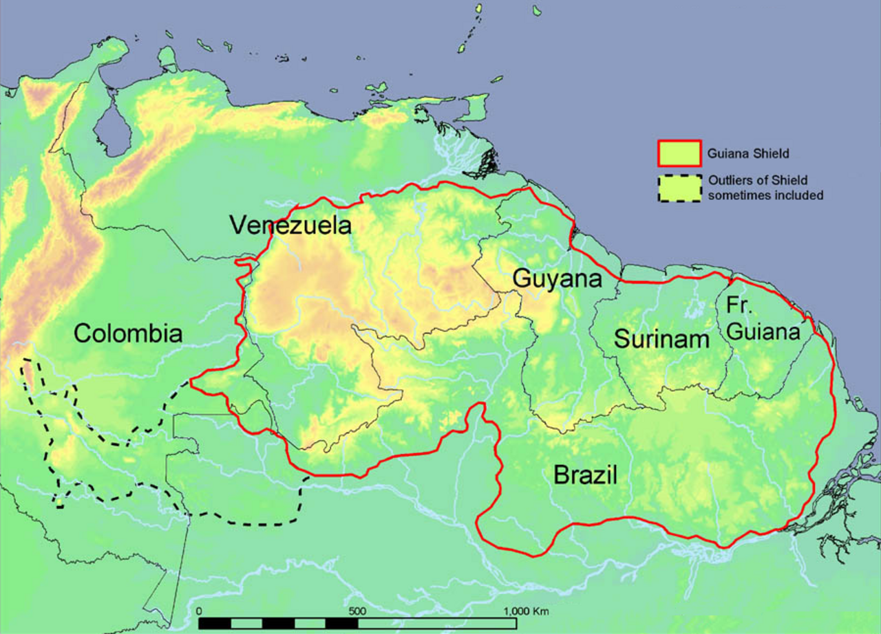
Guiana Shield
Geological Genesis and Structure of an Ancient Craton
The Guiana Shield represents one of the three principal cratons of the South American Plate, a testament to Earth's ancient geological processes. Its formation dates back to the Precambrian era, approximately 1.7 billion years ago, making it a critical component in understanding continental evolution. The shield is primarily composed of highly metamorphosed rocks, including metasediments and metavolcanics (often referred to as greenstones), which form its deep basement.
These ancient rocks are unconformably overlain by relatively undeformed, sub-horizontal layers of sedimentary rocks such as sandstones, quartzites, and shales. Intrusions of younger mafic igneous rocks, like gabbros, further punctuate its geological history. This layered structure, with its ancient crystalline core capped by younger sedimentary sequences, is fundamental to the region's topography and hydrography, providing a stable platform for the development of its distinctive landforms.
The Iconic Tepuis
The most striking geomorphological features of the Guiana Shield are undoubtedly the tepuis, which dominate the Guiana Highlands. These are massive, sheer-sided, flat-topped mountains, essentially erosional remnants of the ancient sandstone caprock. Their formation is a result of differential erosion, where harder sandstone layers resisted weathering and erosion more effectively than the underlying softer rocks.
The extreme vertical relief and isolation of the tepui summits have created unique microclimates and ecological niches, fostering high levels of endemism. These 'islands in the sky' are biological hotspots, harboring species that have evolved in isolation for millions of years, making them invaluable for biodiversity research and conservation efforts. Their dramatic appearance has also inspired myths and legends among indigenous populations.
Hydrographic Powerhouses
The elevated topography of the Guiana Shield, particularly the dramatic escarpments of the tepuis and highlands, serves as the source for some of the world's most spectacular waterfalls. Angel Falls, with its unparalleled vertical drop of 979 meters, is the most famous example, but Kaieteur Falls (a single, massive cascade) and Cuquenan Falls are also significant. These powerful hydrological features are not merely scenic attractions; they are integral to the region's drainage systems.
Rivers originating on the shield carve deep valleys and canyons, contributing vast amounts of freshwater to major river basins. The consistent rainfall in the highlands, coupled with the steep gradients, ensures a continuous and impressive flow, shaping the landscape and supporting the rich ecosystems found at their base.
Ecological Significance and Human History
The Guiana Shield's geological antiquity and topographic diversity have resulted in a region of immense ecological importance. Its vast, relatively undisturbed rainforests and unique tepui ecosystems harbor a significant proportion of South America's biodiversity, including numerous endemic species. For millennia, indigenous peoples have inhabited these lands, developing intricate cultural connections and sustainable practices adapted to the environment.
The shield's geological stability has also preserved a rich paleoenvironmental record, offering insights into past climates and ecosystems. Today, the Guiana Shield faces challenges from resource extraction and deforestation, underscoring the need for careful management to protect its invaluable natural and cultural heritage.
Go deeper
Frequently Asked Questions
What is the Guiana Shield?+
Why are the tepuis called "islands in the sky"?+
How do the waterfalls on the Guiana Shield get so tall?+
Where can we find Angel Falls?+
Why is the Guiana Shield important for wildlife?+
Based on content from Wikipedia · Licensed under CC BY-SA 4.0