

The Ohio River: A Giant Waterway!
Images
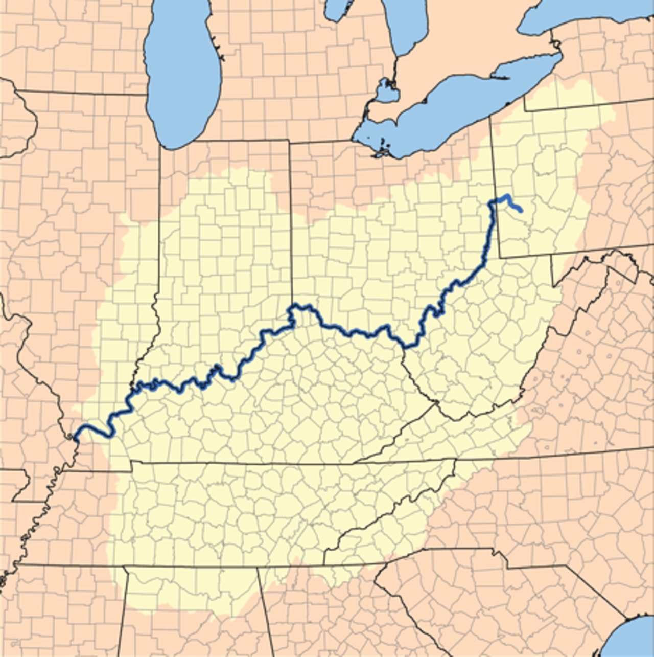
Ohio River
Geomorphological Significance and Hydrological Characteristics
The Ohio River, originating from the confluence of the Allegheny and Monongahela rivers in Pittsburgh, Pennsylvania, is a geologically significant waterway, recognized as the sixth oldest river on the North American continent. Spanning 981 miles, it is the largest tributary by volume to the Mississippi River and ranks third nationally in discharge volume. Its extensive drainage basin, encompassing parts of 14 states, highlights its vast hydrological influence, extending even into the southeastern U.S. via the Tennessee River.
Historically, the river's natural flow, including the formidable 'Falls of the Ohio' rapids near Louisville, presented navigational challenges. However, the 'canalization' of the river, beginning in the 1920s with the construction of locks and dams, transformed it into a series of 21 controlled pools. This engineering feat, while ensuring consistent navigation for commercial traffic and enabling hydroelectric power generation, fundamentally altered the river's natural, free-flowing state, creating a managed aquatic environment.
A Pivotal Axis in American Expansion and Division
The Ohio River's historical trajectory is deeply intertwined with the westward expansion and internal divisions of the United States. Initially serving as a vital artery for pioneers, it facilitated settlement and the growth of new territories. Post-French and Indian War, it demarcated colonial lands from Native American reserves, and later, it formed the southern boundary of the Northwest Territory.
Its role as a geographical and cultural divider intensified as it became an extension of the Mason-Dixon line, separating the Northern and Southern United States and marking the frontier between free and slave territories. For countless enslaved individuals seeking freedom, the Ohio River represented a perilous but critical crossing point, with many aided by the clandestine operations of the Underground Railroad, underscoring its profound significance in the struggle for liberty and equality.
Ecological Transition Zone and Contemporary Environmental Pressures
The Ohio River serves as a significant climatic and ecological transition zone, situated at the periphery of both humid continental and humid subtropical climate regions. This unique geographical position supports a diverse array of flora and fauna, reflecting influences from both climate types. The river's waters are a critical resource, providing drinking water for approximately five million people across its basin.
However, this vital resource faces considerable environmental pressures. Historically and currently, the Ohio River is recognized as one of the more polluted rivers in the United States, a consequence of industrialization, agricultural runoff, and urban development along its extensive course. Managing these pollutants and restoring the river's ecological health remains a significant ongoing challenge, balancing human needs with environmental stewardship.
Economic Engine and Infrastructure Management
As a major navigable waterway, the Ohio River functions as a critical economic engine for the United States. It supports extensive commercial navigation, facilitating the transport of bulk commodities such as coal, grain, and chemicals, thereby reducing overland transportation costs. The system of locks and dams, while primarily designed for navigation, also contributes to regional power generation through hydroelectric facilities.
The river's infrastructure, including ports and terminals, is integral to the supply chains of numerous industries. The management of this complex system requires continuous maintenance and upgrades to ensure efficient and safe passage for commercial vessels, while also considering the ecological impacts of altered flow regimes and the need for flood control measures that protect the communities situated along its banks.
Go deeper
Frequently Asked Questions
What is the Ohio River and why is it important?+
How did people make the Ohio River easier to travel on?+
Why did the Ohio River matter for people looking for freedom?+
How many states does the Ohio River touch and what does it do for them?+
What problems does the Ohio River face today?+
Based on content from Wikipedia · Licensed under CC BY-SA 4.0