

Karakoram
Images
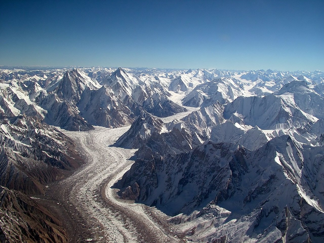
Karakoram
Geopolitical Crossroads and Geological Giants
The Karakoram is a vast and complex mountain range situated at the convergence of major tectonic plates, forming a dramatic landscape that spans the borders of Pakistan, China, and India, with its extremities touching Afghanistan and Tajikistan. This region is a geopolitical hotspot, with its territories being subjects of ongoing territorial disputes. The range's northwestern edge meets the Pamir Mountains, while the Kunlun Mountains lie to its north, separated by the Yarkand and Karakash river valleys.
To the east, it borders the Aksai Chin plateau and the Tibetan Plateau, and its southern boundary is defined by the Indus, Shyok, and Gilgit rivers, which also mark the northwestern extent of the Himalayas. This intricate geographical positioning makes the Karakoram a crucial nexus of cultures, politics, and natural phenomena.
The Frozen Frontier
Remarkably, the Karakoram is the most heavily glaciated region on Earth outside the polar zones. This extensive ice cover is a defining characteristic, influencing the region's climate and hydrology. The Siachen Glacier, at 76 kilometers, and the Biafo Glacier, at 63 kilometers, are the second and third longest glaciers globally, surpassed only by polar ice sheets.
These colossal ice masses are not static; they are dynamic systems that shape the terrain and are critical sources of freshwater for major rivers like the Indus. The meltwater from these glaciers sustains ecosystems and human populations in the arid plains of Pakistan and beyond, highlighting the vital role of the Karakoram's icy heart in regional water security.
Summiting the Sky
The Karakoram is synonymous with extreme altitude, hosting four of the world's fourteen 'eight-thousanders' – mountains exceeding 8,000 meters. The most iconic is K2, Earth's second-highest peak, renowned for its extreme technical difficulty and perilous climbing conditions, earning it the moniker 'Savage Mountain.' Alongside K2 are Gasherbrum I, Broad Peak, and Gasherbrum II, all formidable challenges. In total, the range features eighteen summits above 7,500 meters.
This concentration of ultra-high peaks makes the Karakoram a premier destination for elite mountaineers, pushing the limits of human endurance and exploration against a backdrop of unparalleled natural grandeur.
Historical Pathways and Modern Relevance
Historically, the Karakoram Pass served as a vital artery for trade and cultural exchange between Ladakh and Yarkand, facilitating the movement of goods, ideas, and people across formidable terrain. This ancient route underscores the long-standing human interaction with this challenging environment. Today, while the pass is largely inactive, the Karakoram remains a region of immense strategic and scientific interest.
Its glaciers are crucial indicators of climate change, and their recession has significant implications for water resources. Furthermore, the geopolitical complexities of the region continue to shape international relations, making the Karakoram a landscape of both enduring natural wonder and contemporary global importance.
The Human Element
While the Karakoram is largely characterized by its imposing natural features, small communities inhabit its valleys and foothills. These populations often rely on traditional livelihoods such as agriculture and pastoralism, adapted to the harsh mountain environment. Languages spoken vary across the different political regions, reflecting the diverse cultural tapestry of Central and South Asia.
The challenges of living in such an extreme environment, coupled with geopolitical sensitivities, shape the daily lives and resilience of the people who call the Karakoram home. Understanding their way of life provides a crucial human dimension to this magnificent mountain system.
Go deeper
Based on content from Wikipedia · Licensed under CC BY-SA 4.0