

Harran
Images

Harran Kalesi



Geostrategic Location and Environmental Context
Harran is situated in the Şanlıurfa Province of southeastern Turkey, strategically positioned approximately 40 kilometers southeast of Urfa and a mere 20 kilometers from the Syrian border crossing at Akçakale. This location places it within the historical heartland of Mesopotamia, a region characterized by a semi-arid climate and fertile plains along river systems, though Harran itself is in a drier steppe environment. The area's geography has historically facilitated its role as a crucial nexus for trade and cultural exchange between Anatolia, the Levant, and Mesopotamia.
Its expansive area of 904 km2 encompasses a landscape that, while challenging agriculturally without modern irrigation, has supported human settlement for over four millennia, making its environmental context integral to its historical development and resilience.
Millennia of Imperial Significance and Religious Devotion
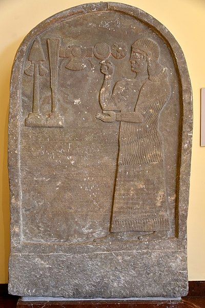
Founded possibly between the 25th and 20th centuries BC, Harran rapidly ascended to prominence as a major Mesopotamian cultural, commercial, and religious hub. Its influence was deeply intertwined with the worship of the moon god Sin, whose temple, Eḫulḫul, was a site of pilgrimage and consultation for prominent rulers. Harran's strategic importance was recognized by the Assyrians, with Adad-nirari I making it a provincial capital, often second only to Assur.
During the collapse of the Neo-Assyrian Empire, Harran served as its final capital (612–609 BC), a testament to its enduring strategic value. The city's significance persisted through subsequent empires, including the Neo-Babylonian, Achaemenid, Macedonian, and Seleucid periods, often becoming a contested territory between the Roman and Parthian/Sasanian empires, most notably as the site of the disastrous Battle of Carrhae in 53 BC.
A Crucible of Knowledge and Architectural Innovation
Beyond its political and religious roles, Harran flourished as a vibrant center of science and learning, particularly during the Islamic period following its capture by the Rashidun Caliphate in 640 AD. It is historically recognized as the site of the first Islamic university, a testament to its intellectual legacy. Furthermore, the Harran Grand Mosque stands as the oldest mosque in Turkey, symbolizing its deep religious roots.
The city twice served as a capital in the Middle Ages, under the Umayyad Caliphate and later the Numayrid Emirate, underscoring its continued administrative importance. Architecturally, Harran is globally renowned for its unique beehive houses, a vernacular building style that has persisted since ancient Mesopotamian times, offering a tangible link to its deep historical past and demonstrating remarkable architectural continuity.
Resilience, Decline, and Modern Revival
The Mongol invasion in 1260 marked a period of significant destruction for Harran, leading to its abandonment for centuries, though it persisted as a military outpost. For the last five centuries, it primarily served as a temporary settlement for nomadic societies. A gradual transition back to a semi-permanent village occurred in the 1840s, and more recently, advancements in local irrigation and agriculture have facilitated its growth into a permanent town.
Harran regained its district status in 1987 and is now a significant local tourist destination. Its journey from an ancient metropolis to a resilient modern town, preserving its unique architectural heritage, highlights its enduring cultural and historical significance in the region.
See also
Frequently Asked Questions
What is Harran?+
Why do Harran's houses look like beehives?+
Where is Harran located?+
When did Harran become an important city?+
What makes Harran special in history?+
Based on content from Wikipedia · Licensed under CC BY-SA 4.0