

Physical geography
Images
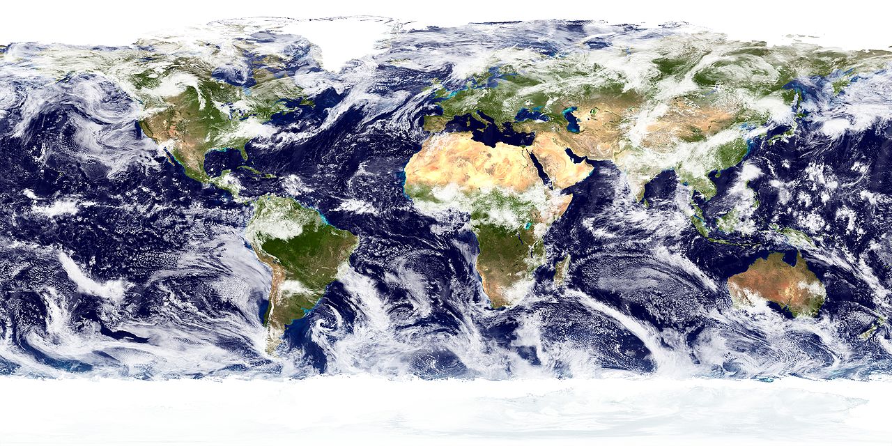
Physical geography
Geomorphic Processes and Landscape Evolution
Physical geography fundamentally examines the Earth's surface, focusing on the processes that create and modify its diverse landforms. This field, geomorphology, investigates the interplay of endogenic (internal) forces, such as tectonic uplift and volcanic activity, and exogenic (external) forces, primarily weathering and erosion driven by water, wind, ice, and gravity. For instance, mountain ranges like the Himalayas are products of continental collision, a slow but immensely powerful endogenic process.
Conversely, river valleys, canyons, and coastal features are sculpted over millennia by fluvial and marine erosion, respectively. Glacial erosion, responsible for U-shaped valleys and fjords, demonstrates ice's formidable power. Understanding the rates and mechanisms of these processes is critical for predicting landscape changes, managing natural resources, and assessing risks from geological hazards like landslides and volcanic eruptions.
The concept of the 'geomorphic system' emphasizes the interconnectedness of these forces, where changes in one component can cascade through the entire system.
Hydrosphere Dynamics
The hydrosphere, encompassing all water on Earth, is a central focus of physical geography, profoundly influencing climate, ecosystems, and human activity. Oceanography within this field studies ocean currents, tides, and wave action, which are vital for global heat distribution and weather patterns. The thermohaline circulation, for example, is a massive oceanic conveyor belt that significantly impacts regional climates. Fluvial geography examines river systems, focusing on drainage basins, discharge variability, and the geomorphic impact of rivers, including sediment transport and flood dynamics.
The cryosphere, comprising all frozen water (glaciers, ice sheets, sea ice, snow), is a sensitive indicator of climate change. Melting glaciers contribute to sea-level rise, while changes in sea ice extent affect polar ecosystems and global albedo. The study of these interconnected water systems is essential for water resource management, coastal protection, and understanding climate feedback loops.
Atmospheric Science and Climatology
Climatology, a core component of physical geography, analyzes the spatial and temporal variations in atmospheric conditions that define climate. This involves understanding the Earth's energy budget, the greenhouse effect, and the drivers of weather systems, such as pressure gradients and jet streams. Factors like latitude, altitude, land-sea distribution, and topography create distinct climatic zones, from tropical rainforests to arid deserts and polar tundras.
The Köppen climate classification system, for instance, categorizes these zones based on temperature and precipitation patterns. Furthermore, physical geography investigates the causes and consequences of climate change, including the role of anthropogenic greenhouse gas emissions, feedback mechanisms (like ice-albedo feedback), and the projected impacts on sea levels, extreme weather events, and biodiversity. This understanding is crucial for developing mitigation and adaptation strategies.
Biogeography and the Human-Environment Interface
Biogeography, the study of the distribution of species and ecosystems across Earth and through geological time, bridges physical and human geography. It examines how physical factors like climate, soil, and landforms influence the types of plants and animals that can survive in a region. For example, soil formation, a slow process influenced by parent material, climate, and biological activity, dictates agricultural potential.
Physical geography also critically analyzes the human-environment interface, exploring how human activities (urbanization, deforestation, agriculture) modify physical landscapes and processes, and conversely, how physical geography influences human settlement patterns, resource use, and cultural development. This reciprocal relationship highlights the interconnectedness of natural systems and human societies, underscoring the need for sustainable practices and integrated environmental management.
Contemporary Relevance and Future Directions
In the 21st century, physical geography is more relevant than ever. Issues like climate change, resource scarcity, natural disaster management, and biodiversity loss demand a deep understanding of Earth's physical systems. Advanced technologies like Geographic Information Systems (GIS), remote sensing (satellite imagery), and sophisticated climate modeling are revolutionizing the field, allowing for more precise analysis and prediction. Future research will likely focus on complex interactions within Earth systems, the impacts of global environmental change on human populations, and the development of resilient landscapes and societies.
Physical geography provides the foundational knowledge necessary to address these global challenges and foster a more sustainable relationship between humanity and the planet.
Go deeper
Frequently Asked Questions
What is physical geography and what does it study?+
How do mountains like the Himalayas get formed?+
Why do rivers carve valleys and create floods?+
What is the thermohaline circulation and why is it important?+
How does melting ice affect the sea level?+
Based on content from Wikipedia · Licensed under CC BY-SA 4.0