

Cataracts of the Nile
Images

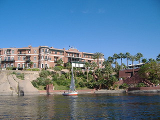
Elephantine Island, a fortified settlement located just before the First Cataract of the Nile, Aswan, Egypt




Geomorphological Dynamics and Hydrological Characteristics
The cataracts of the Nile represent a fascinating interplay between geological structure and fluvial processes. Located primarily between Khartoum and Aswan, these sections are characterized by a dramatic increase in gradient and the presence of resistant igneous and metamorphic rock formations that outcrop from the riverbed. Unlike typical waterfalls, Nile cataracts are more accurately described as extensive stretches of whitewater rapids and shallow, boulder-strewn channels.
The underlying geology, often composed of hard Precambrian rocks, has resisted the erosive power of the river, leading to the formation of these rocky obstructions. The hydrological regime of the Nile, historically characterized by seasonal flooding, further influences the cataracts. During periods of high flow, the rapids can become submerged and less formidable, while during low flow, the shallowness and the sheer number of exposed rocks make navigation exceptionally perilous.
This variability means the cataracts are dynamic features, their appearance and navigability changing significantly throughout the year. The construction of dams, most notably the Aswan High Dam, has fundamentally altered the hydrology, submerging the northernmost cataracts (like the First Cataract near Aswan) and transforming the river's flow dynamics upstream.
Historical Significance
Historically, the cataracts of the Nile served as formidable natural barriers, profoundly shaping the political and economic landscape of ancient Egypt and Nubia. For millennia, they impeded direct riverine transportation between Upper and Lower Egypt, and between Egypt and the regions to the south. This geographical segmentation fostered the development of distinct cultural and political entities.
The cataracts acted as natural borders, influencing military campaigns and the extent of imperial control. For instance, the First Cataract was often considered the southern boundary of ancient Egypt proper, with the regions beyond falling under Nubian influence. Trade was severely impacted; goods had to be portaged overland between navigable stretches, a costly and time-consuming process that limited the scale and efficiency of commerce. However, these barriers also created strategic choke points, where control could be exerted over trade and movement.
Ancient Egyptians recognized their significance, fortifying areas near the cataracts and even attempting to construct canals to bypass them. The cataracts thus played a crucial role in defining historical frontiers and influencing the patterns of interaction and conflict between different peoples along the Nile.
Human Adaptation and Economic Impact
The human history of the Nile cataracts is a story of adaptation and resilience. Communities living in these regions developed specialized knowledge and technologies to cope with the challenging environment. This included the design of unique boat types, such as the Nile felucca, adapted for shallow waters and capable of being sailed or rowed through rapids. Fishing techniques evolved to exploit the diverse aquatic habitats created by the cataracts, with specific methods for catching fish in turbulent waters or in the calmer pools.
Economically, the cataracts presented a dual challenge and opportunity. While they hindered large-scale, long-distance trade, they fostered localized economies centered on portage services, boat building and repair, and specialized fishing. The cataracts also influenced settlement patterns, with communities often clustered in areas where navigation was possible or where overland transport was most feasible.
In modern times, the economic impact has shifted. While dams have reduced the navigational challenges of some cataracts, they have also altered ecosystems. Conversely, the dramatic scenery and historical context of the remaining cataracts have become significant attractions for tourism, offering opportunities for boat tours and cultural experiences that highlight the enduring relationship between people and this powerful river.
Ecological Niches and Modern Relevance
The cataracts of the Nile create unique ecological niches that support distinct aquatic life. The turbulent, oxygen-rich waters of the rapids, combined with the varied substrate of rocks and boulders, provide habitats for specialized fish species adapted to these conditions. The shallower areas and rocky islets also serve as important resting and nesting sites for various bird species.
Historically, these cataracts acted as natural barriers to the upstream and downstream migration of certain aquatic species, contributing to regional biodiversity. The construction of the Aswan High Dam has had a profound ecological impact, submerging several cataracts and altering the river's sediment load and flow patterns. This has led to changes in fish populations and the loss of unique habitats associated with the exposed rapids.
However, the remaining cataracts continue to influence local ecosystems. Their presence can still affect water flow and temperature, creating microhabitats. In contemporary discussions about water management and conservation in the Nile Basin, understanding the role of these geomorphological features is crucial.
They represent a natural heritage that, where preserved, offers insights into the river's historical dynamics and provides valuable ecological services, while also holding potential for sustainable tourism that respects their natural and cultural significance.
See also
Based on content from Wikipedia · Licensed under CC BY-SA 4.0