

Aneto: The Pyrenees' Tallest Friend!
Images
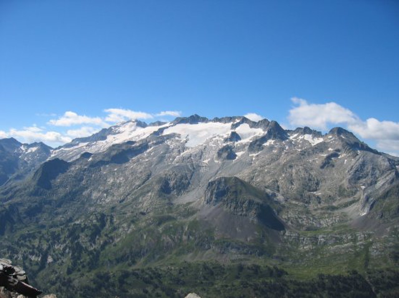
Aneto 01


Geographical Dominance and Strategic Location
Aneto, with its summit reaching 3,404 meters (11,168 feet), is the undisputed geographical apex of the Pyrenees mountain range and the autonomous community of Aragon, Spain. Its position in the Huesca province, a mere 6 kilometers south of the French border, imbues it with strategic significance, marking a prominent natural boundary. Aneto is not an isolated peak but the highest point of the Maladeta massif, a substantial mountain group characterized by its rugged terrain and alpine environment.
The mountain resides within the Posets-Maladeta Natural Park, a protected area established to preserve its unique biodiversity and geological heritage. The Benasque valley, a key geographical feature of the region, provides access and context to Aneto's imposing presence. This high-altitude environment presents extreme climatic conditions, with significant snowfall and low temperatures, shaping both its landscape and the life it supports.
A Chronicle in Stone
The geological composition of Aneto offers a profound glimpse into Earth's deep past. The mountain's core is built upon Paleozoic terrain, comprising ancient granitic rock formations that are hundreds of millions of years old. This robust granite is a product of intense geological processes, likely involving ancient volcanic activity and tectonic uplift.
Layered upon and interspersed with this ancient foundation are Mesozoic materials, representing a later, though still prehistoric, period of geological development. The juxtaposition of these vastly different rock types tells a complex story of mountain formation, erosion, and deposition over immense timescales. Understanding Aneto's geology allows geologists to reconstruct the tectonic history of the Iberian Peninsula and the broader European continent, providing crucial data for scientific research into planetary evolution.
The Vanishing Glacier
Aneto's most dramatic and concerning feature is its glacier, historically the largest in the Pyrenees. Covering approximately 79.6 hectares in 2005, this ice mass has been a defining characteristic of the peak. However, it is rapidly diminishing due to anthropogenic climate change.
Warming summer temperatures and reduced winter precipitation have led to a drastic reduction in its size and thickness. By 2011, it had shrunk to 69.3 hectares, and by 2020, it was a mere 50.0 hectares, losing 8.5 meters in thickness during that period. Current estimates show it at 48.1 hectares in 2022.
This rate of loss, exceeding half its surface area in the last century, suggests a potential disappearance around 2050. The shrinking glacier is a potent symbol of global warming, serving as a critical indicator of environmental change and its far-reaching consequences for mountain ecosystems and water resources.
Ecological Significance and Human Interaction
The Posets-Maladeta Natural Park, encompassing Aneto, is a vital ecosystem supporting specialized flora and fauna adapted to high-altitude, cold environments. The receding glacier, while a cause for concern, also exposes new terrain that can be colonized by pioneer species, initiating new ecological succession. However, the overall impact on endemic species adapted to glacial conditions is negative.
Aneto is a significant destination for mountaineering and ecotourism, attracting visitors who seek to experience its grandeur and natural beauty. This human interaction, while economically beneficial, necessitates careful management to minimize environmental impact. The mountain's status as a natural park underscores a commitment to conservation, yet the existential threat to its glacier highlights the global challenge of balancing human activities with the preservation of natural heritage in the face of climate change.
Governance and Conservation Efforts
Aneto and its surrounding natural park fall under the administrative jurisdiction of the Aragon regional government in Spain. The designation as a Natural Park (Parque Natural) signifies a commitment to protecting its ecological, geological, and landscape values. Management plans are implemented to regulate human activities, such as hiking and climbing, to mitigate environmental impact.
Conservation efforts are increasingly focused on monitoring the glacier's retreat and studying its implications for the local climate and hydrology. The park authorities work to educate the public about the fragility of the mountain environment and the urgent need for climate action. The future of Aneto's glacier is intrinsically linked to global climate policies and the success of international efforts to reduce greenhouse gas emissions.
Go deeper
Frequently Asked Questions
What makes Aneto special in the Pyrenees?+
Where can you find Aneto?+
Why is Aneto’s glacier important?+
How much has Aneto’s glacier shrunk?+
What rocks make up Aneto?+
Based on content from Wikipedia · Licensed under CC BY-SA 4.0