

Uttarakhand
Images

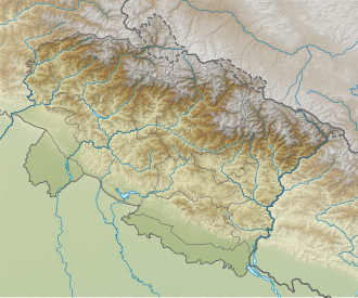
India Uttarakhand location map




Geographical and Administrative Framework
Uttarakhand, formerly Uttaranchal, is strategically located in the northernmost part of India, forming a crucial buffer zone with international borders to its north (China) and east (Nepal). Its northwestern and southern borders are with Himachal Pradesh and Uttar Pradesh, respectively. The state encompasses a significant geographical area of 53,483 km², representing 1.6% of India's total landmass.
Administratively, it is divided into two major divisions: Garhwal and Kumaon, further subdivided into 13 districts. Dehradun serves as the administrative capital, while Nainital holds the status of judicial capital. A defining characteristic of Uttarakhand is its abundant forest cover, which constitutes 45.4% of its geographical area, highlighting its ecological importance. The cultivable land, however, is a smaller proportion at 16%, underscoring the dominance of its mountainous terrain and forest ecosystems.
This geographical setting profoundly influences its culture, economy, and the lives of its inhabitants.
Historical Tapestry and Cultural Roots
The historical narrative of Uttarakhand is deeply rooted in antiquity, with archaeological evidence pointing to human habitation from prehistoric eras. During the Vedic period, the region was integral to the Kuru and Panchal kingdoms, laying the groundwork for its cultural and religious significance. The rise of indigenous dynasties like the Kunindas and the spread of Buddhism, evidenced by Ashokan edicts, further enriched its historical mosaic.
Over centuries, the region developed distinct cultural identities, with its inhabitants identifying as either Garhwali or Kumaoni based on their region of origin. Hinduism forms the predominant religious practice, with Islam being the next largest community. Hindi is the official language, complemented by a rich array of regional languages including Garhwali, Jaunsari, Gurjari, and Kumaoni, reflecting the diverse linguistic heritage shaped by its historical interactions and geographical isolation.
Spiritual Epicenter and Ecological Haven
Uttarakhand's moniker, 'Devabhumi' (Land of the Gods), is a testament to its profound spiritual significance. It is a paramount pilgrimage destination for Hindus, hosting iconic sites such as the Char Dham (Gangotri, Yamunotri, Badrinath, and Kedarnath), Haridwar, Rishikesh, Panch Kedar, and Sapta Badri. These sacred sites attract millions of devotees annually, making religious tourism a cornerstone of the state's identity and economy.
Beyond its spiritual allure, Uttarakhand is an ecological treasure. Its extensive forest cover and pristine Himalayan environment contribute to its status as one of India's greenest states, boasting excellent Air Quality Index (AQI). The state is also home to two UNESCO World Heritage Sites, further underscoring its global importance for both cultural and natural heritage.
This dual identity as a spiritual hub and an ecological sanctuary shapes its development trajectory.
Economic Evolution and Modern Relevance
While historically reliant on agriculture and hydropower, Uttarakhand's economy has undergone a significant transformation, with the service sector now being the primary driver. Travel, tourism, and the hotel industry are the leading contributors to its Gross State Domestic Product (GSDP), which stands at approximately ₹3.78 lakh crore (US$45 billion). This economic shift highlights the state's successful pivot towards leveraging its natural and cultural assets for growth. The state's political representation in the national legislature, with five seats in the Lok Sabha and three in the Rajya Sabha, ensures its participation in India's broader governance.
Uttarakhand's emphasis on sustainable development, conservation, and promoting its unique cultural heritage positions it as a vital region in India's contemporary landscape, balancing economic progress with environmental stewardship and spiritual traditions.
Go deeper
Frequently Asked Questions
What is Uttarakhand known for?+
Where is Uttarakhand located?+
Why do so many people visit Uttarakhand?+
How many districts are in Uttarakhand?+
What languages do people speak in Uttarakhand?+
Based on content from Wikipedia · Licensed under CC BY-SA 4.0