

Spandau
Images
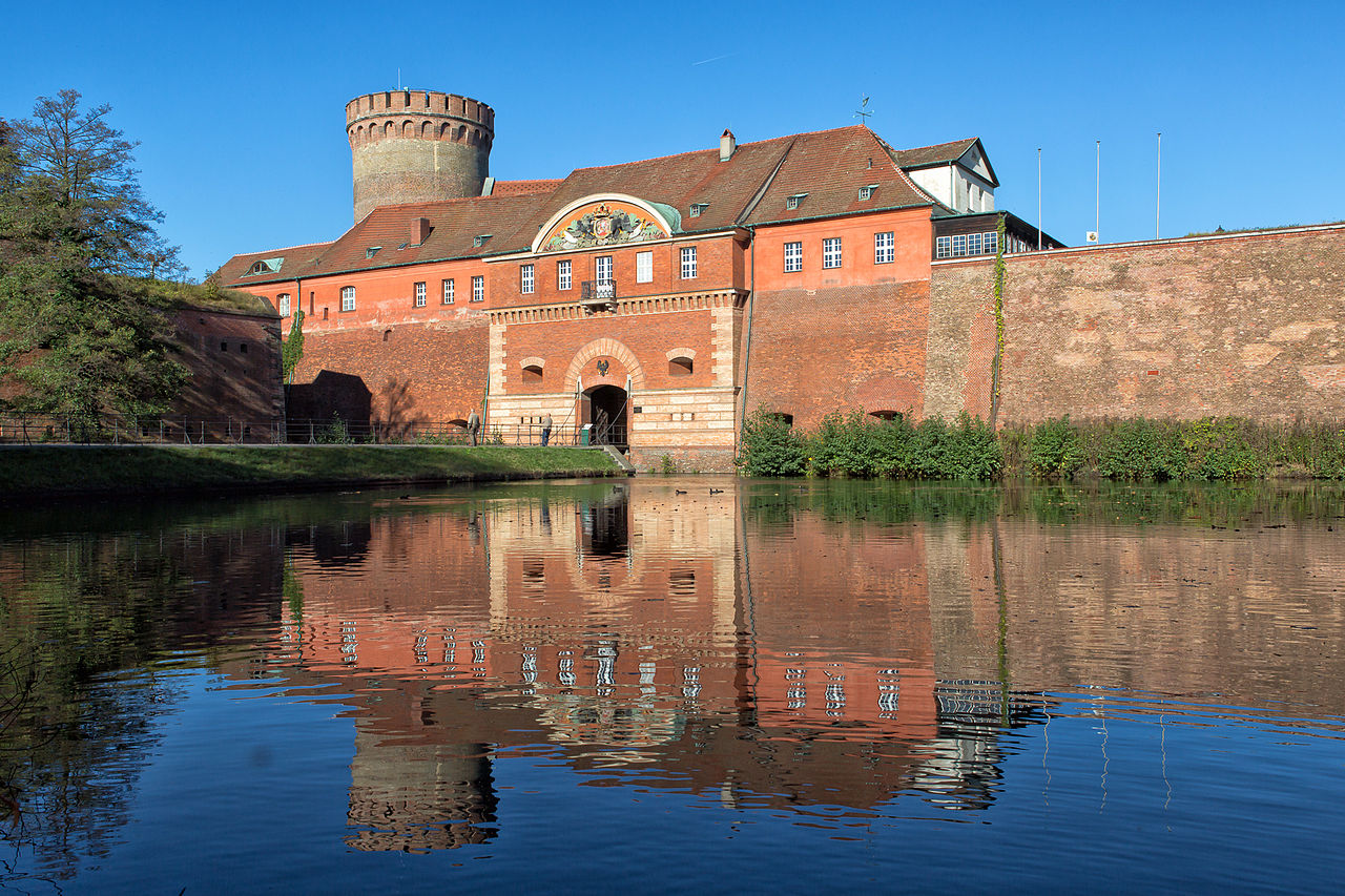
Zitadelle Spandau - Berlin - 2014




Geomorphological Significance and Spatial Extent
Spandau occupies a critical geographical position as the westernmost administrative borough of Berlin, Germany. Its defining characteristic is its location at the confluence of the Havel and Spree rivers, a natural nexus that has historically influenced its development and continues to shape its landscape. The borough extends along the western bank of the Havel, creating a distinct spatial configuration.
While Spandau is noted as the smallest borough in terms of population density within Berlin, it ranks as the fourth largest by land area. This considerable landmass, coupled with its significant riverine frontage, suggests a landscape that likely balances urban development with natural or semi-natural areas, potentially including parks, recreational zones, and industrial or residential districts situated along its waterways. The interplay between the two rivers dictates much of its topography and hydrological features, making it a unique geographical entity within the urban fabric of Berlin.
Historical Evolution and Strategic Importance
The history of Spandau is a narrative of strategic importance and gradual urban evolution. Historically, Spandau was not merely a settlement but a fortified town, often serving as a crucial defensive outpost for the Brandenburg region and later Prussia. Its location at the confluence of navigable rivers made it a vital point for trade and military control.
Over centuries, Spandau transitioned from a distinct municipality to an integral part of Berlin. This process involved periods of growth, industrialization, and significant historical events, including its role during various conflicts and political shifts in German history. The borough's historical trajectory reflects broader patterns of German urban development, from medieval fortifications to modern city expansion.
Understanding its past is essential to grasping its current identity and its contribution to Berlin's multifaceted heritage.
Socio-Cultural Fabric and Demographics
As the westernmost borough, Spandau presents a distinct socio-cultural profile within Berlin. While sharing the official language of German with the rest of the city and the country, its specific cultural nuances are shaped by its history and geographical setting. As the smallest borough by population, it might offer a more intimate community feel compared to densely populated areas, though its large land area suggests a diverse range of residential and commercial zones.
The demographic composition would reflect the broader patterns of migration and settlement within Berlin, but its specific location might attract particular types of residents or industries. The daily life in Spandau is characterized by the routines of its inhabitants, who engage in work, education, and leisure activities, contributing to the borough's unique social dynamics. Its identity is a blend of its historical legacy and its contemporary role as a residential and functional district within a global city.
Economic Landscape and Functional Role
While specific economic data for Spandau is not detailed in the provided source, its position as a large borough within Berlin implies a significant economic function. Its geographical advantage, particularly its riverine access via the Havel, suggests potential for logistical and trade-related activities. Historically, Spandau has been associated with industrial development, and it is plausible that remnants or modern iterations of these industries persist, alongside a growing service sector characteristic of contemporary urban economies.
The borough likely hosts a variety of businesses, from small local enterprises to larger commercial operations, contributing to Berlin's overall economic output. The employment of its residents, whether within Spandau or commuting to other parts of the city, forms a crucial component of its economic landscape. Its role is multifaceted, serving as a residential area, a commercial hub, and potentially an industrial zone, all contributing to the economic vitality of the German capital.
Governance and Educational Framework
Spandau functions as one of the twelve administrative boroughs (Bezirke) of Berlin, meaning it operates under the city's overarching governmental structure. Each borough has its own local administration, responsible for managing local affairs, public services, and urban planning within its designated area. This decentralized approach allows for tailored governance that addresses the specific needs of each borough.
In terms of education, Spandau, like all of Berlin, provides a comprehensive educational system. This includes primary schools, secondary schools, and potentially vocational training institutions. The educational institutions within Spandau are integral to fostering the development of its younger population, equipping them with the knowledge and skills necessary for future participation in society and the workforce.
The presence and quality of these educational facilities are vital components of the borough's social infrastructure and its long-term development.
Go deeper
Frequently Asked Questions
Where is Spandau located in Berlin?+
Why are the Havel and Spree rivers important to Spandau?+
How did Spandau become part of Berlin?+
What kinds of places can you find in Spandau?+
Why was Spandau a strong defensive town in the past?+
Based on content from Wikipedia · Licensed under CC BY-SA 4.0