

Reinickendorf: Berlin's Awesome Northwest!
Images

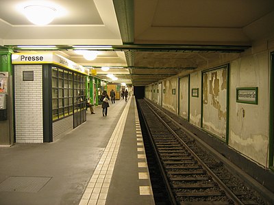
Reinickendorf-ubahn




Geographical Context and Environmental Features of Reinickendorf
Reinickendorf, situated in the northwestern quadrant of Berlin, presents a multifaceted geographical profile. Its landscape is characterized by a significant natural asset, Lake Tegel, which is one of Berlin's largest lakes and a crucial element for the borough's recreational appeal and ecological balance. The presence of this extensive water body influences local microclimates and provides vital habitats for various species.
Historically, the area also hosted Berlin Tegel Airport (TXL), a major international airport that profoundly shaped Reinickendorf's connectivity and economic landscape for decades. Although now closed for commercial aviation, its legacy and the surrounding infrastructure continue to influence urban planning and development. The borough exhibits a distinct dichotomy in its residential areas: from spacious, single-family home settlements that offer a suburban tranquility, to extensive, high-density housing estates like Märkisches Viertel, which represent a significant example of post-war urban planning aimed at addressing housing shortages.
This geographical diversity contributes to Reinickendorf's unique character as a borough that balances urban density with access to natural environments and historical infrastructure.
Historical Trajectory
The evolution of Reinickendorf from a collection of rural villages into a major urban borough is a narrative of Berlin's rapid expansion and transformation. Initially comprising small agricultural communities, Reinickendorf began to be integrated into the growing metropolis during the late 19th and early 20th centuries. Significant urban development accelerated in the post-World War II era, driven by the need for housing and the strategic importance of the area.
The construction of Märkisches Viertel in the 1960s and 1970s stands as a monumental example of large-scale social housing projects, designed to house tens of thousands of residents and create a self-contained urban environment. Concurrently, the development and expansion of Tegel Airport positioned Reinickendorf as a critical gateway for Berlin, fostering economic activity and international connections. This period of intense development transformed the borough's landscape, infrastructure, and demographic composition, laying the groundwork for its current status as a complex and diverse district within the German capital.
Socio-Cultural Fabric and Community Dynamics
Reinickendorf is characterized by a diverse population, reflecting Berlin's status as a multicultural capital. The primary language is German, but like many large urban areas, it hosts a variety of linguistic and cultural backgrounds. The borough's residential structure, with its mix of detached houses and large housing estates, fosters different community dynamics.
Areas with single-family homes often cultivate a more traditional neighborhood feel, while large estates like Märkisches Viertel have developed their own distinct social identities and community initiatives. Residents engage in a wide array of daily activities, from commuting to work in other parts of Berlin to utilizing local amenities and recreational facilities. Lake Tegel serves as a significant communal space, offering opportunities for leisure and social interaction, particularly during warmer months.
The borough's development has aimed to provide comprehensive social infrastructure, including schools, cultural centers, and public services, contributing to the quality of life for its inhabitants and fostering a sense of belonging within this expansive urban district.
Economic Landscape and Infrastructure's Enduring Impact
The economic profile of Reinickendorf has been historically intertwined with its significant infrastructure, most notably the former Berlin Tegel Airport. While the airport's closure for commercial flights has necessitated economic adaptation, the legacy of its presence continues to influence the borough. The area surrounding Tegel remains a site of potential redevelopment and economic activity, with a focus on innovation, research, and logistics.
Reinickendorf hosts a range of businesses, from small local enterprises serving residential needs to larger commercial operations. The borough's well-developed transportation network, including road and public transit links, facilitates economic exchange and allows for efficient commuting. The presence of diverse housing types also supports a local economy focused on services, retail, and maintenance.
Future economic development in Reinickendorf is likely to leverage its strategic location, existing infrastructure, and the ongoing urban regeneration efforts within Berlin.
Governance and Urban Planning in Reinickendorf
As the twelfth borough of Berlin, Reinickendorf is governed as part of the city-state's administrative structure. Its governance involves a district mayor and a district council (Bezirksverordnetenversammlung), which are responsible for local administrative tasks, urban planning, and the provision of public services within the borough's boundaries. Decisions regarding land use, development projects, and community facilities are made at this level, often in coordination with the broader Berlin city government.
Urban planning in Reinickendorf has historically focused on addressing housing needs, as evidenced by the development of large housing estates, and on integrating major infrastructure projects like the airport. Current planning efforts likely focus on adapting to the post-airport era, enhancing green spaces, improving public transportation, and fostering sustainable urban development. The borough's governance aims to balance the needs of its diverse population with the strategic objectives of the city of Berlin, ensuring the continued development and well-being of its residents.
See also
Frequently Asked Questions
What is Lake Tegel and why is it special in Reinickendorf?+
Why was Tegel Airport important to Reinickendorf?+
What is Märkisches Viertel and what does it look like?+
How did Reinickendorf change from villages to a big borough?+
What kinds of homes can you find in Reinickendorf?+
Based on content from Wikipedia · Licensed under CC BY-SA 4.0