

New Madrid, Missouri
Images

Flooded farm New Madrid, Missouri


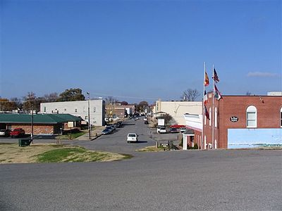


Geographical Peculiarities
New Madrid, Missouri, occupies a distinctive geographical position within the Mississippi River basin. It is situated on the north side of the Kentucky Bend, a remarkable oxbow formation of the Mississippi River. This bend is so pronounced that it creates an exclave of Fulton County, Kentucky, west of the main river channel, surrounded by Missouri territory.
This geographical anomaly is a testament to the dynamic nature of the Mississippi River. Scientists anticipate that, over geological time, the river will likely breach the narrow neck of the peninsula, straightening its course and potentially isolating the Kentucky landmass as an island. This ongoing process highlights the river's power to reshape landscapes and influences the region's hydrology and ecological patterns.
The town's proximity to this major waterway has historically dictated its development and economic activities, particularly in transportation and trade.
The 1811-1812 Earthquake Sequence
The historical identity of New Madrid is inextricably linked to the catastrophic earthquake sequence of 1811-1812. This series of powerful seismic events, originating near the town, represents the most intense earthquake activity ever recorded in the contiguous United States. The tremors were so profound that they caused widespread liquefaction of the soil, created new lakes (such as Reelfoot Lake in Tennessee), and dramatically altered the topography.
Perhaps most astonishingly, the earthquakes temporarily reversed the flow of the Mississippi River, a phenomenon that defied the expectations of observers at the time. The seismic waves were felt as far away as Boston and New Orleans. The legacy of these earthquakes continues to inform seismic hazard assessments for the New Madrid Seismic Zone, underscoring the region's geological significance and the potential for future seismic activity.
Socioeconomic Fabric and Economic Drivers
With a population of 2,787 residents as of the 2020 census, New Madrid is a small city that functions as the county seat of New Madrid County. Its socioeconomic structure is influenced by its rural setting and its reliance on key industries. Agriculture remains a significant economic driver, with fertile land in the Mississippi Delta region supporting crop production.
Additionally, the Mississippi River plays a vital role in the local economy through commercial navigation. Barges transport bulk commodities like grain, coal, and chemicals, providing employment and supporting related logistical services. The town's relatively small size fosters a sense of community, but also presents challenges in terms of economic diversification and infrastructure development compared to larger urban centers.
Governance and Civic Structure
As the county seat, New Madrid holds a central position in the administrative and political landscape of New Madrid County. The city operates under a municipal government structure, likely a mayor-council or council-manager system, responsible for providing essential public services. These include law enforcement, fire protection, public works, and recreational facilities.
The governance of New Madrid involves elected officials who represent the interests of its citizens and manage the city's budget and development plans. The county government, headquartered in New Madrid, oversees broader county-level functions, including courts, elections, and public health services, ensuring the effective administration of the region.
Educational Landscape and Historical Preservation
The educational system in New Madrid serves the town's youth, providing them with foundational knowledge and skills. Students typically attend local public schools within the New Madrid County R-I School District, which aims to offer comprehensive K-12 education. The curriculum likely includes standard subjects like mathematics, science, language arts, and social studies, with an emphasis on local history, particularly the significant 1811-1812 earthquakes.
Beyond formal schooling, the town's history is a key educational element. Efforts are made to preserve the memory and geological impact of the earthquakes through local historical societies and potentially educational exhibits. This focus on history ensures that future generations understand the unique geological and geographical forces that have shaped their community.
See also
Based on content from Wikipedia · Licensed under CC BY-SA 4.0