

Bathymetry: What's Under the Waves?
Images

Bathymetry


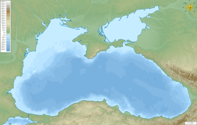


Foundations and Methodologies in Bathymetric Surveying
Bathymetry, derived from the Greek words 'bathos' (depth) and 'metron' (measure), is the scientific discipline concerned with the underwater depth of the Earth's oceans, seas, or lakes. Its primary objective is to create detailed maps of the seafloor topography. Historically, bathymetry relied on lead line soundings, a laborious process of lowering a weighted rope or wire until it hit the bottom.
Modern bathymetry predominantly employs acoustic methods, with multibeam echo sounders being the industry standard. These systems emit sound waves in a fan shape, allowing for the simultaneous measurement of depth across a wide swath of the seafloor. Single-beam echo sounders, while simpler, provide depth data only directly beneath the survey vessel.
Other advanced techniques include side-scan sonar for imaging seafloor features and interferometric sonar for high-resolution terrain mapping. The accuracy of bathymetric data is paramount, influenced by factors such as water density, temperature, salinity, and the precision of the vessel's positioning system (e.g., GPS).
The Dynamic Topography of the Ocean Floor
The ocean floor is a landscape of immense geological significance and dramatic variation. Bathymetric surveys reveal features that rival or surpass terrestrial counterparts in scale. The global mid-ocean ridge system, a continuous underwater mountain range, spans over 65,000 kilometers, marking the boundaries where tectonic plates diverge.
Conversely, oceanic trenches, such as the Mariana Trench reaching depths of nearly 11,000 meters, represent the deepest known points on Earth, formed by the subduction of one tectonic plate beneath another. Continental shelves, the submerged edges of continents, and continental slopes, which descend steeply to the abyssal plains, are also key bathymetric features. These plains, vast and flat, cover significant portions of the ocean floor.
Understanding these features is fundamental to plate tectonics, volcanology, and seismology, as many geological events originate or manifest on the seafloor.
Navigational, Environmental, and Resource Implications
The practical applications of bathymetry are extensive and critical. For maritime navigation, accurate nautical charts derived from bathymetric data are indispensable for safe passage, preventing collisions with submerged obstacles and guiding vessels through channels. In environmental science, bathymetric maps help in understanding oceanographic processes, including the circulation of water masses, the distribution of marine habitats, and the impact of underwater geological features on marine life.
They are also crucial for managing marine protected areas and studying the effects of climate change, such as sea-level rise and the stability of underwater ice masses. Furthermore, bathymetry is vital for the exploration and extraction of offshore resources, including hydrocarbons, minerals, and for the strategic placement of undersea infrastructure like telecommunication cables and pipelines.
Technological Advancements and Future Directions
The field of bathymetry is continually evolving with technological advancements. High-resolution multibeam sonar systems provide increasingly detailed seafloor imagery, enabling the identification of smaller features and improving the accuracy of geological interpretations. Autonomous Underwater Vehicles (AUVs) and Remotely Operated Vehicles (ROVs) equipped with advanced sensors allow for more targeted and in-depth surveys of challenging or remote areas. Satellite-derived bathymetry (SDB) is emerging as a cost-effective method for mapping shallow coastal waters, utilizing optical satellite imagery.
Future research is focused on integrating bathymetric data with other geophysical datasets, developing more sophisticated data processing algorithms, and enhancing real-time data acquisition and dissemination. The ongoing effort to map the entire ocean floor to a high standard remains a significant, long-term goal for the scientific community.
See also
Frequently Asked Questions
What is bathymetry?+
How do scientists measure the ocean floor?+
What are some big features found on the ocean floor?+
Why do we need bathymetry for ships?+
What tools do we use to map the sea bottom?+
Based on content from Wikipedia · Licensed under CC BY-SA 4.0