

Rain and Snow Mixed: The Wobbly Weather!
Images

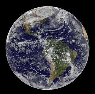
Major Winter Storm Marches Across Central U.S.




Defining the Nuances of Mixed Precipitation
Rain and snow mixed, often termed 'sleet' in Commonwealth English, represents a specific form of hydrometeor characterized by the simultaneous presence of liquid raindrops and partially melted snowflakes. Unlike true sleet (ice pellets) which are solid spheres of ice, or freezing rain which is supercooled liquid water that freezes upon impact, this precipitation is soft and translucent. Its texture is akin to slush, containing residual ice crystals from snowflakes that have undergone partial melting.
This phenomenon typically occurs briefly, signifying a transitional phase in atmospheric conditions. It is a meteorological indicator that the temperature profile within the atmosphere is delicately balanced, allowing for the coexistence of melting and freezing processes as precipitation descends.
The Thermodynamics of Mixed Precipitation Formation
The formation of mixed rain and snow is governed by specific thermodynamic profiles within the atmosphere. Snowflakes originate in clouds where temperatures are below freezing. As these snowflakes descend, they encounter atmospheric layers with temperatures above freezing.
If the depth of this warm layer is insufficient, or if the snowflakes fall through it rapidly, they will not melt completely. Instead, they become partially melted, forming a slushy consistency. Upon reaching the surface, this mixture is neither fully liquid nor fully solid snow.
The key differentiator from freezing rain is that the ice crystals retain some structure, and the water is not supercooled. Meteorologists use detailed atmospheric sounding data to predict the likelihood and duration of such events, often noting the METAR codes RASN (rain and snow) or SNRA (snow and rain) to denote its occurrence.
Significance and Impact on Surface Conditions
The occurrence of mixed rain and snow has practical implications for weather forecasting and public safety. Its presence often heralds an impending change in weather, typically signaling a shift from a warmer, rain-dominated system to a colder, snow-dominated one, or vice versa. This transitional nature means that accumulation patterns can be complex; while the ground might be too warm for snow to stick initially, the mixed precipitation can still create slick surfaces.
When temperatures drop further, this slush can freeze, leading to hazardous ice. Understanding the dynamics of mixed precipitation is crucial for accurate short-term forecasts, particularly concerning road conditions, aviation safety, and the potential for localized flooding if drainage systems become overwhelmed by the combined rain and melting snow.
Historical Context and Scientific Understanding
The phenomenon of mixed rain and snow is a naturally occurring meteorological event, not an invention. Its 'discovery' is intrinsically linked to the development of meteorology as a science. Early observations of weather patterns by naturalists and later by formalized meteorological services laid the groundwork for understanding precipitation types.
The systematic study of atmospheric layers and their impact on falling hydrometeors, particularly through the use of weather balloons and advanced forecasting models, has refined our ability to predict these events. While no single individual is credited with 'discovering' mixed rain and snow, figures like Vilhelm Bjerknes, a pioneer in numerical weather prediction, and countless other atmospheric scientists have contributed to the sophisticated understanding of the atmospheric processes that lead to its formation.
Geographical Distribution and Predictive Indicators
Mixed rain and snow is most prevalent in mid-latitude regions where atmospheric temperatures frequently fluctuate around the freezing point. This includes areas that experience distinct seasons, particularly during the transition periods of autumn and spring. Coastal regions and areas near large bodies of water can also experience this phenomenon due to moderating temperature effects.
Predictive indicators for mixed precipitation include observing surface temperatures near 0°C (32°F), analyzing upper-air temperature profiles for the presence of a melting layer above a sub-freezing layer near the surface, and monitoring radar signatures that show a mix of liquid and frozen precipitation. The specific sequence and depth of these temperature layers are critical for distinguishing it from other forms of winter precipitation.
See also
Frequently Asked Questions
What is mixed rain and snow?+
Why does mixed rain and snow happen?+
How can mixed rain and snow affect roads?+
When do we see mixed rain and snow?+
Are mixed rain and snow dangerous?+
Based on content from Wikipedia · Licensed under CC BY-SA 4.0