

Noor (satellite)
Images
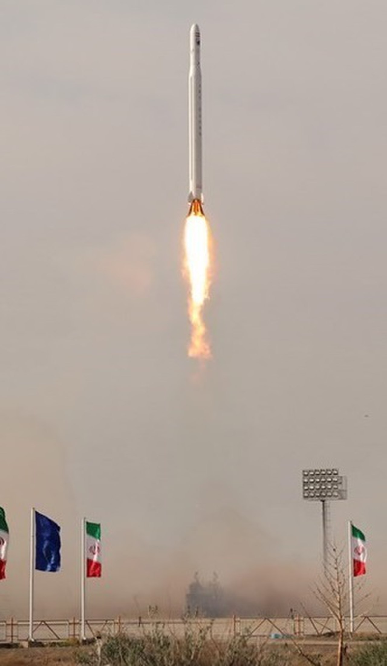
Noor (satellite)

A Milestone in Iran's Space Program
The launch of the Noor satellite on April 22, 2020, marked a significant milestone for Iran, representing its first successful deployment of a military and Earth observation satellite into orbit. Launched by a Qased rocket from the Imam Khomeini Spaceport, Noor was placed into an orbit approximately 425 kilometers (264 miles) above Earth. This achievement demonstrated Iran's advancing indigenous capabilities in satellite technology, including design, manufacturing, and launch operations.
The satellite's dual designation as both military and observational underscores its strategic importance, providing Iran with enhanced reconnaissance and surveillance capabilities while also contributing to scientific data collection about the planet.
Technological Underpinnings and Mission Objectives
Noor is equipped with optical imaging sensors, enabling it to capture high-resolution photographs of Earth's surface. The primary mission objectives revolve around providing detailed imagery for various applications. These include monitoring geographical changes, assessing natural resources, supporting agricultural planning, and aiding in disaster response efforts.
From a military perspective, the data acquired by Noor can be utilized for intelligence gathering, border monitoring, and strategic assessment. The satellite's operational altitude allows for a balance between detailed imaging and broad coverage, making its data valuable for both tactical and strategic analyses, as well as for scientific research into Earth systems.
Geopolitical Context and International Significance
The successful launch of Noor occurred within a complex geopolitical landscape, drawing international attention and analysis. For Iran, it signifies a step towards greater self-reliance in space technology, a domain often intertwined with national security and prestige. The development and deployment of such satellites can be viewed as indicators of a nation's technological prowess and its aspirations on the global stage.
The international community closely monitors the capabilities and applications of such satellites, particularly those with potential dual-use (civilian and military) applications, due to their implications for regional and global security dynamics and the broader landscape of space governance.
Noor's Contribution to Earth Science and Future Prospects
Beyond its strategic implications, Noor contributes valuable data to the field of Earth science. The optical imagery it provides can be used by researchers to study a myriad of phenomena, from urban sprawl and desertification to changes in ice cover and water bodies. This continuous stream of data aids in building comprehensive models of Earth's climate and environment, supporting efforts to understand and mitigate global challenges like climate change.
The success of the Noor program also paves the way for future Iranian satellite missions, potentially involving more advanced sensors and broader operational capabilities, further enhancing Iran's role in space exploration and Earth observation.
See also
Frequently Asked Questions
What is the Noor satellite?+
When was Noor launched?+
How high above Earth does Noor orbit?+
Why does Noor take pictures of Earth?+
What can scientists and people do with Noor's pictures?+
Based on content from Wikipedia · Licensed under CC BY-SA 4.0