
Warm Front: The Gentle Giant of Weather!
Images

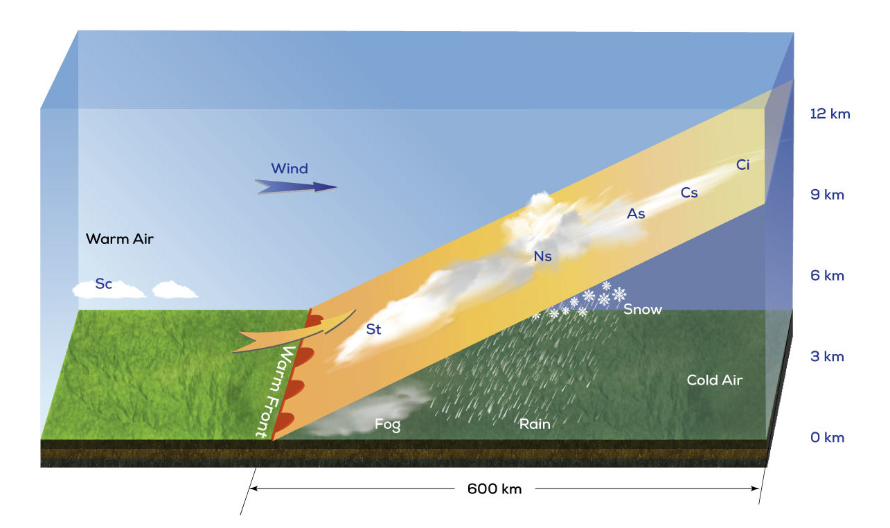
Example of a warm front


Key Facts
Where Do Warm Fronts Come From?
Warm fronts are like big blankets of warm air that decide to go on an adventure! They start in warmer places, like near the equator, and then slowly travel towards cooler spots. Think of them as a gentle giant moving across the land.
They are a type of 'density discontinuity,' which just means the warm air is lighter and floats over the cooler air it meets. This makes them move slower than their speedy cousins, the cold fronts!
What Happens When a Warm Front Arrives?
When a warm front is coming, the sky often gets a little shy. You might see thin, wispy clouds appear first, like streaks of paint. Then, as the front gets closer, the clouds get thicker and darker, like a big gray blanket.
This is when the rain or snow might start, often falling gently for a long time. Sometimes, before the rain, you might even see fog, like the world is hiding under a soft, white sheet!
The Big Change After the Front!
Once the warm front has passed over, get ready for a change! The air usually feels much warmer and more comfortable, like stepping into a cozy room. The clouds might break up, and the sun could peek through. If the warm air was a bit bubbly and excited, you might even have some thunderstorms with lightning and thunder. But usually, it's a nice, warm feeling that stays for a while.
How Do We See a Warm Front on a Map?
Weather scientists are super smart and have a special way to draw warm fronts on their maps. They use a red line with little red bumps, like tiny half-circles, all along it. These bumps point in the direction the warm front is traveling. It's like a secret code that tells everyone, 'Watch out, warm, cozy weather is on its way!' This helps us know what kind of weather to expect.
Based on content from Wikipedia · Licensed under CC BY-SA 4.0