

Vosges
Images

Geoloc-Vosges-Relief


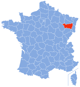


Geological Genesis and Geographical Significance
The Vosges mountain range, situated in Eastern France near the German border, represents a prominent geomorphological unit. Extending from the Burgundian Gate in the south to the Börrstadt Basin in the north, it forms a substantial natural feature. This range, along with the Palatine Forest to its north in Germany, constitutes a cohesive low mountain range spanning approximately 8,000 square kilometers.
The Vosges meticulously defines the western boundary of the Upper Rhine Plain, a crucial geographical and economic corridor. Its formation is a testament to long-term geological processes, likely involving tectonic activity and subsequent erosion, which sculpted its characteristic rounded peaks and undulating topography. The range's north-northeast orientation is a key aspect of its geographical structure, influencing regional drainage patterns and acting as a natural barrier.
Topographical Features and Altitudinal Variation
The Vosges are characterized by a series of medium-height mountains, distinct from the more dramatic alpine landscapes. The highest summit is the Grand Ballon, reaching an impressive elevation of 1,424 meters (4,672 feet). This altitudinal peak is followed closely by Storkenkopf at 1,366 meters and Hohneck at 1,364 meters.
These summits, while not exceptionally high by global standards, are significant within their regional context. They create a varied topography featuring steep slopes, sheltered valleys, and plateaus. The altitudinal gradient influences vegetation zones, soil types, and microclimates, contributing to the ecological diversity of the range.
The presence of these peaks also dictates precipitation patterns, often leading to higher rainfall on the western slopes compared to the rain shadow effect on the eastern side facing the Rhine Plain.
Climatic Influence and Hydrological Role
The Vosges mountains exert a considerable influence on regional climate and hydrology. Their elevation causes orographic lift, leading to increased precipitation, particularly on the windward western slopes. This consistent moisture sustains the extensive forests that dominate the landscape, contributing significantly to the region's biodiversity and carbon sequestration.
The climate within the Vosges is generally cooler and more humid than in the adjacent Upper Rhine Plain. Seasonal variations are pronounced, with cold, snowy winters at higher elevations and mild summers. This climatic regime supports unique flora and fauna adapted to montane environments.
Furthermore, the Vosges act as a crucial watershed, with numerous rivers and streams originating in its mountains, supplying water to downstream communities and ecosystems.
Geological History and Landscape Evolution
The Vosges, as a low mountain range, have a geological history rooted in ancient geological events. While the provided text doesn't detail its specific formation, mountain ranges of this type are typically formed through processes like fault-block uplift or the erosion of ancient plateaus. The rounded summits suggest significant periods of erosion, likely by glaciers during past ice ages and by water and wind over millennia.
This long evolutionary process has shaped the distinctive landscape, creating the rolling hills and valleys seen today. Understanding the geological timescale involved highlights the dynamic nature of Earth's crust and the persistent forces that sculpt our planet's surface over vast stretches of time.
Socio-Economic and Environmental Context
While the source material focuses on the physical geography, the Vosges range has historically been a region of human settlement and economic activity. Its forests have provided timber resources, and its valleys have supported agriculture and pastoralism. The range's position as a border region has also imbued it with historical and cultural significance, often serving as a buffer or a point of contention between France and Germany.
Today, the Vosges are recognized for their natural beauty, attracting tourism and outdoor recreation. The preservation of its ecosystems and the sustainable management of its resources are ongoing considerations, balancing economic needs with environmental conservation. The range serves as a vital natural heritage site, offering insights into both geological history and ecological resilience.
Go deeper
Frequently Asked Questions
What are the Vosges?+
How tall is the highest peak in the Vosges?+
Why do the Vosges have lots of forests?+
Where does the water from the Vosges go?+
How do the Vosges affect the weather?+
Based on content from Wikipedia · Licensed under CC BY-SA 4.0