

Venezuelan Andes
Images

Pico Humboldt Venezuela


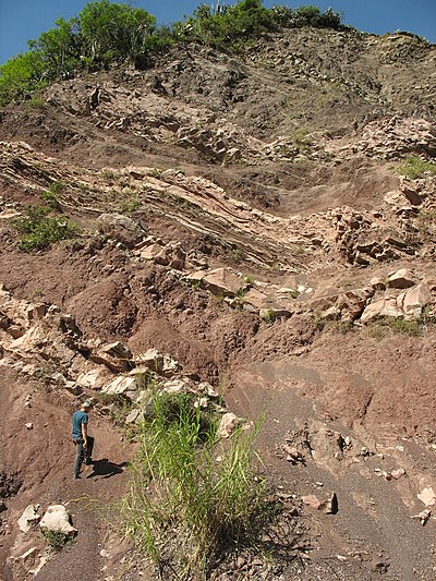
Geological Genesis and Morphological Expression
The Venezuelan Andes represent the terminal bifurcation of the Colombian Eastern Cordillera, a significant geological event that shaped the northern reaches of the Andes mountain system. This mountainous region is geologically distinct, defined by its origin, constituent rocks, and structural composition. Within Venezuelan territory, the system diverges into two primary branches: the Sierra de Perijá, a smaller range oriented southwest to northeast, and the more substantial Cordillera de Mérida, which forms the core of the Venezuelan Andes.
The Cordillera de Mérida, with its extensive area, is characterized by complex geological structures and a relief that includes Venezuela's highest elevations. The formation of these mountains is a testament to the powerful tectonic forces that have shaped the South American continent over millions of years, creating a dramatic and varied landscape.
Altitudinal Zonation and Climatic Diversity
The extreme altitudinal variation within the Venezuelan Andes gives rise to a remarkable spectrum of climatic zones and ecological communities. From the humid subtropical lower slopes to the frigid páramo ecosystems at higher elevations, each zone supports distinct flora and fauna. The páramo, in particular, is a unique high-altitude grassland characterized by its specialized vegetation, such as the iconic frailejón, which has adapted to survive harsh conditions, including intense solar radiation, strong winds, and significant diurnal temperature fluctuations.
This altitudinal zonation is crucial for understanding the region's biodiversity, as different species are adapted to specific temperature ranges, precipitation patterns, and soil types found at various elevations.
Ecological Significance and Endemism
The Venezuelan Andes are a critical hotspot for biodiversity, harboring a significant number of endemic species. The isolation provided by the mountain ranges, coupled with diverse microclimates, has fostered the evolution of unique life forms found nowhere else on Earth. These include various species of amphibians, reptiles, birds, and plants, many of which are highly specialized to their particular habitats within the Andes.
The cloud forests, for instance, are renowned for their rich orchid diversity and numerous insect species. The páramo ecosystems are also vital, playing a significant role in water regulation for downstream communities. The ecological integrity of the Venezuelan Andes is therefore of paramount importance for regional and global conservation efforts.
Human Habitation and Socio-Economic Dynamics
Human settlement in the Venezuelan Andes dates back millennia, with indigenous communities adapting to the challenging high-altitude environment. Today, the region supports a diverse population engaged in various economic activities. Agriculture remains a cornerstone, with communities cultivating crops like coffee, potatoes, and various fruits suited to the mountain climate.
The rugged terrain influences settlement patterns, often leading to dispersed rural communities and concentrated urban centers in more accessible valleys. The region's cultural landscape is rich, reflecting a blend of indigenous traditions and colonial influences. The main cities serve as administrative, commercial, and cultural hubs, connecting the mountain communities to the broader Venezuelan economy and society.
Governmental and Educational Frameworks
The Venezuelan Andes are administered as part of the larger Venezuelan state, with governance structures operating at national, regional, and local levels. The specific administrative divisions within the Andean states are responsible for implementing national policies and managing regional resources. Education in the Venezuelan Andes follows the national curriculum, with institutions ranging from primary schools in rural villages to universities in major cities like Mérida.
The Universidad de Los Andes (ULA) in Mérida is a prominent institution, contributing significantly to research, particularly in fields relevant to the Andean environment, such as biology, geology, and agricultural sciences. Access to education can be a challenge in remote mountainous areas, but efforts are made to ensure educational opportunities are available across the region.
See also
Frequently Asked Questions
What are the Venezuelan Andes?+
Why do the Venezuelan Andes have different climates?+
How do plants survive in the high páramo?+
What kinds of animals live only in the Venezuelan Andes?+
How do people grow food in the Andes?+
Based on content from Wikipedia · Licensed under CC BY-SA 4.0