

Triple Divide Peak (Montana)
Images
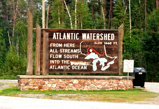
Continental Divide, Ontario Highway 11, Between Fort Frances and Thunder Bay, Ontario


The Confluence of Continental Divides
Triple Divide Peak, situated within the Lewis Range of Montana's Glacier National Park, is a mountain of profound geographical significance. Reaching an elevation of 8,025 feet (2,446 meters), it is distinguished not merely by its height but by its unique position as the hydrological apex of the North American continent. This designation arises from its status as the meeting point for two of the continent's most critical hydrological boundaries: the Continental Divide of the Americas and the Northern or Laurentian Divide.
The Continental Divide separates waters flowing eastward towards the Atlantic and Arctic Oceans from those flowing westward to the Pacific. The Northern Divide, conversely, delineates drainage basins flowing north into the Arctic Ocean from those flowing south into the Great Lakes and ultimately the Atlantic. The convergence of these two major divides at Triple Divide Peak creates an exceptionally rare triple watershed point, directing precipitation towards three distinct oceanic basins.
Hydrological Implications and Drainage Patterns
The water originating from Triple Divide Peak embarks on journeys to vastly different global destinations. Precipitation falling on its western slopes contributes to the headwaters of rivers that eventually reach the Pacific Ocean. Meltwater from the northern slopes feeds streams and rivers that flow into the Arctic Ocean, a region experiencing rapid environmental change.
Water from the eastern aspects of the peak joins systems that ultimately drain into the Atlantic Ocean, either directly or via the extensive network of the Great Lakes and the St. Lawrence River. This complex drainage pattern underscores the peak's role in the continent's water cycle, influencing ecosystems, climate, and human activities across immense distances.
Understanding these watershed dynamics is crucial for water resource management, ecological studies, and climate modeling.
Geological Formation and Alpine Environment
The Lewis Range, including Triple Divide Peak, is characterized by its ancient geological history, formed through complex tectonic processes and shaped by extensive glaciation. The rugged topography, sharp peaks, and U-shaped valleys are testaments to the powerful erosive forces of past ice ages. The alpine environment at and around Triple Divide Peak is characterized by harsh climatic conditions, including low temperatures, high winds, and significant snowfall, which persists year-round in some areas.
This extreme environment supports a specialized array of flora and fauna, including hardy alpine grasses, wildflowers, and resilient animal species adapted to high-altitude survival. The ecological integrity of this region is a key focus for Glacier National Park, which strives to preserve these unique natural systems.
Conservation and Scientific Relevance
Triple Divide Peak and its surrounding parklands are vital for scientific research. Studies conducted here contribute to our understanding of hydrology, climatology, ecology, and geology. The peak's role as a hydrological apex makes it a natural laboratory for observing how climate change impacts snowpack, meltwater runoff, and downstream water availability. Conservation efforts within Glacier National Park aim to protect this sensitive alpine ecosystem and its critical watershed functions.
The peak serves as a powerful symbol of the interconnectedness of North America's natural systems and highlights the importance of preserving these high-elevation environments for their ecological services and scientific value.
Human Interaction and Exploration
While the summit of Triple Divide Peak is challenging to access, the surrounding areas of Glacier National Park are popular destinations for hikers, climbers, and nature enthusiasts. The park offers numerous trails that provide stunning views of the Lewis Range and opportunities to learn about the region's unique geography and ecology. Historically, indigenous peoples have long inhabited and utilized the lands surrounding the Rockies, developing deep knowledge of the natural world.
Modern exploration and scientific study continue to reveal the complexities of this landscape. The peak's designation as a hydrological apex has made it a point of interest for geographers and environmental scientists, drawing attention to its critical role in the continent's water systems.
See also
Frequently Asked Questions
What is Triple Divide Peak?+
How tall is Triple Divide Peak?+
Where does the water from Triple Divide Peak go?+
Why is Triple Divide Peak special for scientists?+
What kind of plants and animals live near Triple Divide Peak?+
Based on content from Wikipedia · Licensed under CC BY-SA 4.0