

Graupel: Snow's Little Cousins!
Images
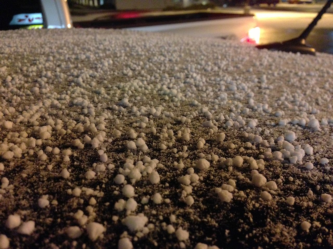
Graupel
The Genesis of Graupel
Graupel represents a fascinating intersection of snowflake growth and cloud microphysics. Its formation is initiated when a nascent ice crystal, or snowflake, descends through a cloud layer containing a significant concentration of supercooled liquid water droplets. These droplets, existing at temperatures below 0°C but not yet solidified, are crucial.
Upon collision with the falling snowflake, these supercooled droplets undergo rapid freezing, a process known as riming. This accretion of rime ice is what transforms the delicate, crystalline structure of a snowflake into the characteristic opaque, granular pellet of graupel. Unlike the clear, layered ice of hail, graupel's rime is typically porous and white due to the trapped air within the frozen droplets.
The size of graupel particles, generally ranging from 2 to 5 millimeters, is a direct result of the duration and intensity of the riming process. This process is distinct from the formation of ice pellets (sleet), which involves the refreezing of melted snowflakes, and hail, which is formed through repeated cycles of updraft and downdraft within cumulonimbus clouds.
Distinguishing Graupel
Graupel occupies a unique niche within the spectrum of frozen precipitation, differentiated by its formation mechanism, physical characteristics, and typical meteorological context. Hail, the most commonly contrasted form, is characterized by its hardness, density, and often substantial size, a consequence of intense updrafts in thunderstorms that allow for repeated accretion cycles. Ice pellets, or sleet, are essentially frozen raindrops or refrozen snowflakes that have melted and refrozen, resulting in small, translucent ice spheres.
Graupel, conversely, is defined by its softness and granular texture, stemming from the direct accretion of supercooled droplets onto a snowflake. This makes graupel less dense and more fragile than hail or ice pellets. While graupel can occur in thunderstorms alongside hail, it also frequently falls during winter storms, particularly when temperatures are just below freezing, and at higher altitudes where supercooled droplets are prevalent.
Its presence is often indicative of specific atmospheric conditions that favor riming over melting or intense convective growth.
Meteorological Significance and Observational Clues
The observation of graupel holds considerable meteorological significance, offering insights into atmospheric conditions that might not be immediately apparent. Its occurrence signals the presence of supercooled liquid water within clouds at temperatures where ice crystals are also forming. This coexistence of liquid and solid phases is critical for understanding cloud dynamics and precipitation processes.
For weather forecasters, identifying graupel can help refine precipitation type forecasts, especially during transitional periods between snow, rain, and freezing rain. The METAR code 'GS' is used to report graupel, a designation that aids in standardized weather reporting and analysis. Furthermore, the conditions that lead to graupel formation can sometimes be associated with more complex weather systems, including frontal passages or orographic lifting, where air is forced upward over mountains.
Studying graupel contributes to a more comprehensive understanding of atmospheric thermodynamics and microphysics, aiding in the development of more accurate weather models and prediction systems.
Graupel in the Broader Context of Climate and Environment
While graupel is a transient meteorological phenomenon, its formation and distribution are indirectly influenced by broader climatic trends. Changes in atmospheric temperature and moisture content, driven by climate change, can alter the frequency and intensity of conditions favorable for graupel formation. For instance, shifts in the freezing level or the prevalence of supercooled water droplets could impact where and when graupel is observed.
Although graupel itself is not a direct indicator of climate change, understanding its formation mechanisms and its role in precipitation patterns contributes to the larger scientific effort to model and predict future climate scenarios. The study of graupel, therefore, extends beyond immediate weather forecasting to encompass a deeper appreciation of Earth's atmospheric processes and their potential evolution in a changing climate. It serves as a reminder of the intricate and dynamic nature of our planet's weather systems.
Go deeper
Frequently Asked Questions
What is graupel and how is it different from snow or hail?+
How does graupel form in the clouds?+
Why is graupel usually only 2 to 5 millimeters big?+
When do we see graupel falling from the sky?+
How do weather people know when graupel is falling?+
Based on content from Wikipedia · Licensed under CC BY-SA 4.0