

Gambela Region
Images

Openverse Image


Geographical Significance and Riverine Systems
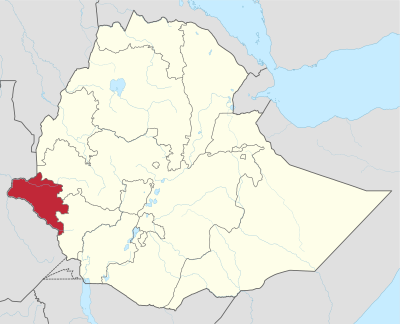
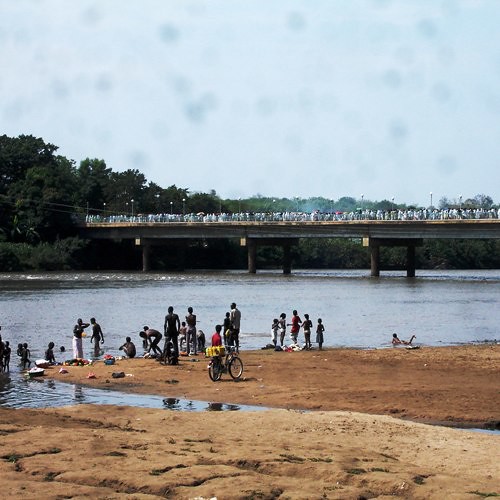
The Gambela Region, officially the Gambela Peoples' Region, is situated in the westernmost part of Ethiopia, presenting a distinct geographical profile. Its landscape is dominated by the Baro and Akobo Rivers, which are not merely features but crucial lifelines. The Baro River, in particular, is navigable for a significant portion of the year and historically served as an important transport route, connecting the region to Sudan and beyond.
The presence of these major rivers, along with the Openo River, dictates much of the region's ecology, agriculture, and settlement patterns. The terrain is largely characterized by plains and wetlands, making it a unique biome within Ethiopia's more mountainous interior. This geographical setting influences its climate, biodiversity, and the economic activities possible within its borders, such as fishing and agriculture, often dependent on seasonal flooding and river levels.
A Tapestry of Ethnic Diversity and Identity
Gambela is renowned for its remarkable ethnic diversity, a characteristic that is reflected in its official name, the Gambela Peoples' Region. The region is home to several distinct indigenous groups, with the Anuak and Nuer being the most prominent. These communities possess unique languages, cultural practices, and historical narratives that contribute to the region's vibrant social fabric.
Other groups, including the Majang Komo and Opo, also inhabit Gambela, further enriching its cultural mosaic. The coexistence of these diverse peoples presents both opportunities for cultural exchange and challenges related to resource allocation and political representation. Understanding Gambela requires appreciating the distinct identities and historical experiences of its various ethnic communities.
Strategic Location and Border Dynamics
The geopolitical positioning of Gambela is a defining aspect of its identity. Bordering South Sudan to the west, Gambela serves as a critical interface between Ethiopia and its neighboring nation. This proximity has significant implications, influencing trade, migration patterns, and regional security dynamics.
Historically, the border region has seen periods of both cooperation and tension, particularly given the complex political landscape of South Sudan. Gambela's role as a borderland means it is often a point of entry and exit, affecting its demographics and economy. Its location also places it in relation to other Ethiopian regions, namely the Oromia Region to the east and the South West Ethiopia Region to the south, creating a complex web of inter-regional connections and administrative boundaries.
Demographics and Regional Scale
In terms of scale, Gambela is one of Ethiopia's smaller administrative regions, covering an area of approximately 29,783 square kilometers. This makes it comparable in size to countries like Belgium or smaller U.S. states. However, its population of around 525,000 inhabitants positions it as one of the least populous regions in Ethiopia.
This combination of a substantial land area with a relatively low population density means that much of Gambela's territory is sparsely inhabited, characterized by open plains and natural landscapes. This demographic profile has implications for development strategies, infrastructure planning, and the management of natural resources within the region.
Historical Context and Administrative Evolution
Gambela's administrative history is marked by evolution. Previously known as Region 12, its transformation into the Gambela Peoples' Region signifies a move towards recognizing and empowering its diverse ethnic groups. This administrative restructuring reflects broader trends in Ethiopia's federal system, which aims to grant greater autonomy to regions based on ethnic and cultural lines.
The region's capital, Gambela town, serves as its administrative and economic hub. Understanding Gambela's present requires acknowledging its past, including its colonial-era administrative arrangements and its integration into the modern Ethiopian state, all of which have shaped its unique character and challenges.
See also
Frequently Asked Questions
What is the Gambela Region in Ethiopia?+
Why are the Baro and Akobo Rivers important to Gambela?+
Who are the main ethnic groups in Gambela?+
Where does Gambela border?+
How big is Gambela compared to other places?+
Based on content from Wikipedia · Licensed under CC BY-SA 4.0