

Galeras
Images

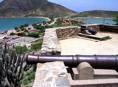
Escudo de Galera (Granada)


Geological Setting and Topography of Galeras
Galeras is a prominent stratovolcano situated in the Nariño department of southwestern Colombia, in close proximity to the departmental capital, Pasto. Rising to an elevation of 4,276 meters (14,029 feet) above sea level, it is a significant feature of the Andean mountain range, a geologically active zone characterized by numerous volcanoes. As a stratovolcano, Galeras is characterized by its steep, conical shape, formed by the accumulation of viscous lava flows, pyroclastic deposits, and ash from successive eruptions.
Its summit caldera, though modified by subsequent activity, is a testament to its eruptive history. The surrounding landscape is a direct product of volcanic processes, featuring fertile soils enriched by ash, but also areas prone to lahars (volcanic mudflows) and pyroclastic flows. The climate varies dramatically with altitude, from tropical conditions at lower elevations to alpine conditions near the summit, influencing vegetation patterns and human settlement.
A Chronicle of Volcanic Activity and Historical Eruptions
Galeras boasts one of the most active volcanic records in Colombia. Its eruptive history dates back centuries, with the first documented eruption occurring on December 7, 1580. Since the Spanish conquest, it has experienced numerous eruptions, ranging in intensity.
The volcano's activity is closely monitored by the Colombian Geological Survey (Servicio Geológico Colombiano). A particularly tragic and scientifically significant event was the 1993 eruption. This eruption occurred unexpectedly while a group of six scientists and three tourists were inside the volcano's crater, conducting research on gas emissions and gravity measurements.
The eruption tragically killed all nine individuals, serving as a somber reminder of the inherent dangers of volcanic research and the unpredictable nature of Galeras. This event spurred significant advancements in volcanic monitoring and hazard assessment protocols in Colombia and globally.
Indigenous Heritage and Modern Communities
The name 'Galeras' is relatively recent, with historical records indicating that the indigenous populations who inhabited the region prior to the arrival of Europeans referred to the volcano by the name Urcunina. This ancient appellation signifies a deep historical and cultural connection between the land and its original inhabitants, suggesting a reverence or understanding of the volcano's power. Today, Galeras is a defining feature of the Nariño department, with the bustling city of Pasto located just a short distance away.
The proximity of a major urban center to such an active volcano presents unique challenges and opportunities. The communities living in the vicinity have developed a complex relationship with Galeras, balancing the risks of volcanic hazards with the benefits of living in a region with fertile volcanic soils and striking natural beauty. This coexistence necessitates continuous hazard awareness and preparedness.
Scientific Monitoring and Hazard Mitigation
Galeras is currently classified as Colombia's most active volcano, making it a critical site for ongoing scientific research and monitoring. Institutions like the Colombian Geological Survey employ a sophisticated network of instruments to track seismic activity, ground deformation, gas emissions, and thermal anomalies. The primary objective of this continuous surveillance is to improve the accuracy and timeliness of eruption forecasts, thereby enhancing public safety.
The 1993 eruption, despite its tragic outcome, provided invaluable data that has since been used to refine predictive models and hazard maps. Understanding the complex magmatic system beneath Galeras is crucial for anticipating future eruptive styles and magnitudes. This scientific endeavor is not merely academic; it is a vital component of disaster risk reduction for the hundreds of thousands of people living within the potential impact zones of the volcano.
Socio-Economic Landscape and Education
The Nariño department, with Pasto as its capital, is a region where agriculture, particularly on the fertile volcanic slopes, plays a significant role in the economy. The rich soils, enriched by past eruptions, support the cultivation of crops like potatoes, coffee, and various fruits. However, the constant threat of volcanic activity necessitates careful land-use planning and robust emergency response systems. Education in the region is influenced by the unique geographical context.
Schools in areas surrounding Galeras often incorporate lessons on volcanic hazards, safety procedures, and the science behind volcanology into their curriculum. This educational approach aims to foster a culture of preparedness and scientific literacy among younger generations, ensuring they are well-informed about the natural forces that shape their environment. Universities in nearby cities often have programs that collaborate with geological institutes for research and training.
See also
Frequently Asked Questions
What is Galeras?+
How tall is Galeras?+
Why is Galeras dangerous?+
When did Galeras first erupt?+
What happens when scientists study Galeras?+
Based on content from Wikipedia · Licensed under CC BY-SA 4.0