
Beringia: The Land Bridge That Was!
Images
Beringia Land Bridge Noaagov


Key Facts
Where Was This Amazing Place?
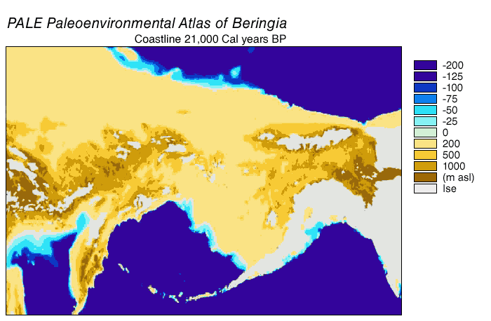
Beringia was a huge area of land that used to connect what is now Russia and North America. It stretched from the Lena River in Russia all the way to the Mackenzie River in Canada. It was so big, it covered parts of the Arctic Ocean and even the Bering Sea!
Today, only a few islands are left where the land bridge used to be, like St. Lawrence Island. It was a very cold and icy place back then, like a super-sized winter wonderland!
A Bridge for Animals and People!
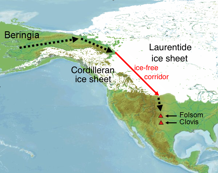
This giant land bridge was super important because animals and early humans could walk across it! Think of it like a giant highway connecting two continents. Animals like mammoths and saber-toothed cats might have used it to travel. Even people, thousands of years ago, walked from Asia to North America using Beringia. They were some of the first people to explore the Americas!
When Did It Disappear?
Beringia wasn't always underwater! It was a land bridge for a very long time, especially during the Ice Age when lots of water was frozen into ice. But as the Earth got warmer, the ice melted, and the sea levels rose. The land bridge slowly got covered by water, disappearing about 11,000 years ago. It's like when your sandcastle slowly gets washed away by the tide!
What's Left of Beringia Today?
Even though the giant land bridge is gone, we can still see parts of it! The Bering Strait is the water that is now where the middle of the bridge used to be. Islands like the Diomede Islands and St. Lawrence Island are like the leftover pieces of the old land bridge. Scientists study these places to learn all about Beringia and the amazing journeys people and animals took long, long ago.
Based on content from Wikipedia · Licensed under CC BY-SA 4.0