

Allegheny River
Images
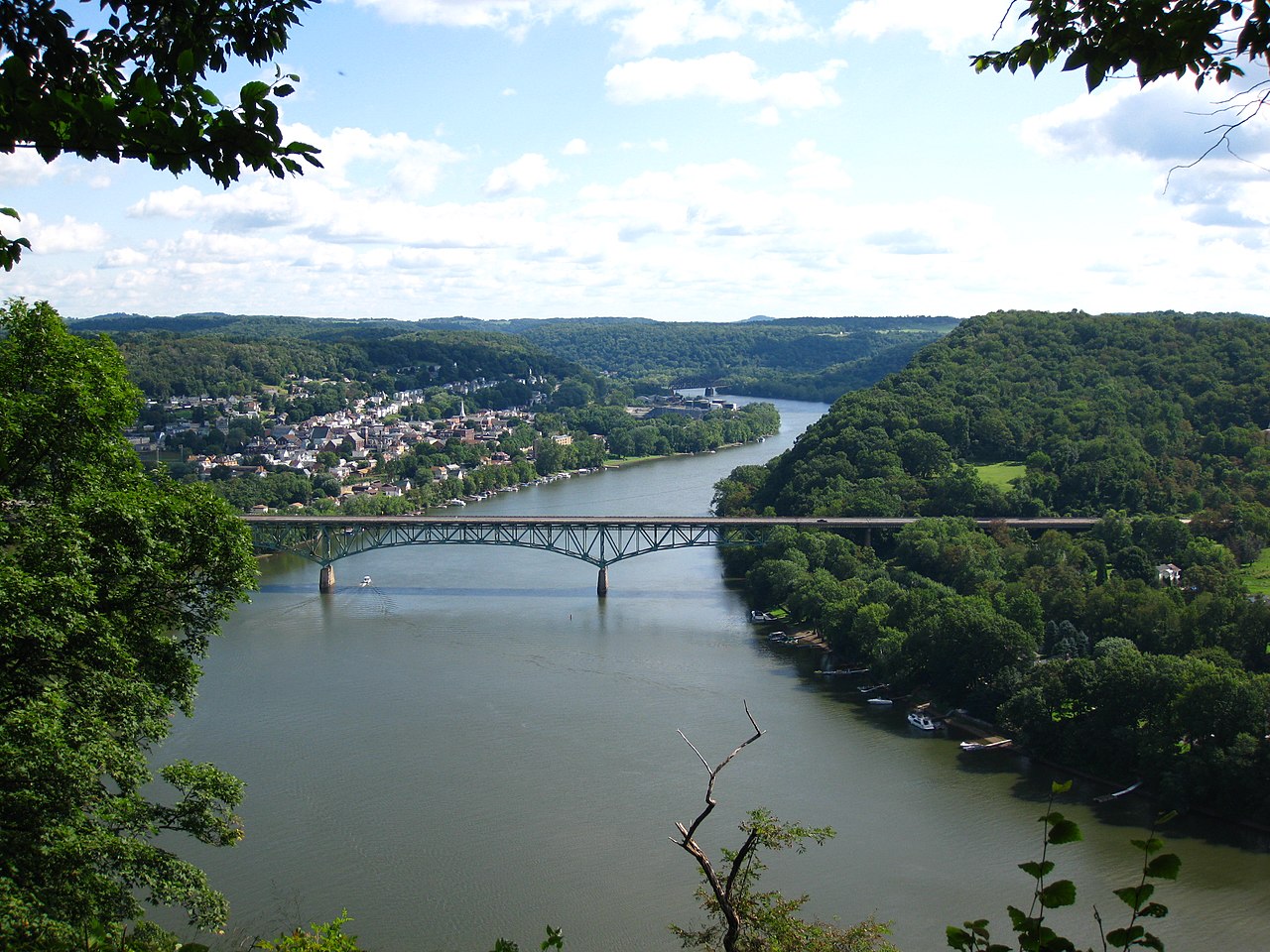
Freeport Bridge


Geomorphology and Hydrological Dominance
The Allegheny River, spanning 325 miles, is a paramount example of fluvial geomorphology in the northeastern United States, primarily traversing western Pennsylvania and a portion of New York. Its headwaters originate just below the 42nd parallel north, initiating a complex trajectory that includes northwestern flow into New York, followed by a pronounced southwesterly zigzag across state lines. This intricate path culminates in Pittsburgh, where it converges with the Monongahela River to form the Ohio River.
Hydrologically, the Allegheny is exceptionally significant, recognized as the principal headstream of the Ohio River, and by extension, the Mississippi River system. This designation underscores its role in shaping the drainage basin of one of North America's most extensive river networks. Historically, its prominence was acknowledged by both indigenous populations and early European settlers, who often considered the Allegheny itself to be the upper Ohio, highlighting its substantial discharge and perceived importance in the regional watershed.
Engineering for Navigation and Flood Control
The Allegheny's utility as a transportation corridor has been significantly enhanced through extensive hydrological engineering. Beginning in the early 20th century, a series of locks and dams were constructed, extending navigability upstream from Pittsburgh to East Brady. This infrastructure was crucial for facilitating commercial barge traffic and economic development along the river.
A more recent and monumental engineering feat is the Kinzua Dam, completed in 1965. This massive structure impounds the Allegheny River, creating the 24-mile-long Allegheny Reservoir in Warren and McKean counties, Pennsylvania, and Cattaraugus County, New York. The primary objective of the Kinzua Dam was flood control, mitigating the risk of devastating inundation for downstream communities.
However, the reservoir also serves secondary purposes, including hydroelectric power generation, water supply, and extensive recreational opportunities, showcasing the multifaceted impact of large-scale water management projects.
Etymological Enigma and Indigenous Heritage
The name 'Allegheny' presents a compelling etymological puzzle, rooted in pre-Columbian indigenous languages. Its precise origin remains elusive, with scholars suggesting derivations from various Delaware/Unami phrases. These potential source words are often homophones of the English rendition, carrying diverse meanings that reflect the rich linguistic landscape of the region's original inhabitants.
The ambiguity surrounding the name underscores the deep historical connection between the river and the Native American tribes who navigated and inhabited its watershed for millennia. Studying the etymology of 'Allegheny' offers a window into the cultural narratives and historical interactions that shaped the identity of this significant geographical feature, connecting modern understanding to ancient traditions and languages.
Socio-Economic and Ecological Interplay
The Allegheny River has been a cornerstone of socio-economic development and ecological balance in its region for centuries. Historically, it served as a vital artery for trade, resource extraction, and settlement, influencing the growth patterns of numerous communities. The river's navigability, enhanced by modern engineering, continues to support economic activity through freight transportation.
Beyond commerce, the Allegheny watershed is a critical ecological zone, supporting diverse flora and fauna. The Allegheny Reservoir, while a product of engineering for flood control, has also created new habitats and recreational economies centered around water-based activities like fishing and boating. The river's health and management are therefore intrinsically linked to the economic vitality and environmental sustainability of the areas it touches, presenting ongoing challenges and opportunities for conservation and development.
Governance and Educational Context
The governance and management of the Allegheny River's resources involve multiple layers of federal, state, and local authorities, reflecting its status as a major interstate waterway and a key component of national infrastructure. The U.S. Army Corps of Engineers plays a significant role in managing the locks and dams for navigation and the Kinzua Dam for flood control, operating under federal mandates.
State agencies in Pennsylvania and New York oversee water quality, environmental protection, and recreational use within their respective jurisdictions. Local governments manage land use and development along the riverbanks. Educationally, the Allegheny River serves as a living laboratory for understanding geography, environmental science, history, and engineering.
Universities and schools utilize the river and its watershed for research, fieldwork, and curriculum development, fostering an informed populace aware of the river's complex ecological, economic, and historical significance. Educational initiatives often focus on watershed management, conservation efforts, and the impact of human activities on riverine ecosystems.
See also
Frequently Asked Questions
What is the Allegheny River?+
How long is the Allegheny River?+
What is the Kinzua Dam and why was it built?+
Where does the Allegheny River start and where does it end?+
What does the name 'Allegheny' mean?+
Based on content from Wikipedia · Licensed under CC BY-SA 4.0